Oranjemund, Namibia. It seems to be the largest diamond mine vehicle graveyard, and yet there are barely any pictures of it. Satellite photos of the area could let you guess how big it is. The mine owned by De Beers is reputed to have the largest private earthmoving fleet in the world.
From the texts I have found here and there, my understanding is that that people are not allowed to visit those the area for safety reasons, hence the lack of available photos.
This tank was last used in industry, not war; after World War II, the diamond miners of Oranjemund used surplus tanks to bulldoze sand.
Once a machine has been used for diamond harvesting in the De beers mine, it won't leave the mine anymore, even after it's Obsolete. Machines of any types have been piling up in the graveyard since the 1900's. The reason seems to be that people could find diamonds trapped in those old machines. I don't know why the company do not dismantle them in search of possible lost gems though...
A map of the graveyard, each point is supposedly a vehicle
And some more few miles north.
coordinates : 28°26'09.22"S 16°16'06.37"E
google map
pictures sources : 1 2
text source : 1 2
Artificial Owl recommends:
The diamond mine vehicle graveyard of Namibia
| .Namibia, Mine, Tank, Truck, Vehicle Graveyard | 7 comments »Abandoned oil rig in the desert, Skeleton Coast, near Toscanini, Namibia
| .Namibia, Industrial Facility | 1 comments »
This is an abandoned oil drilling rig that was operational in the late '60s and early 70's. At the centre is the main power unit, a V16 Caterpillar engine. Erected by hopeful entrepreneurs long before the National Park was actualyl proclaimed. Today, it provides a perfect nesting area for birds during the breeding season.


coordinates : 20°53'24.44"S 13°26'50.10"E
google map
pictures sources : 1 2 3 4 5 6
text source : 1
Artificial Owl recommends:

Read more [+]

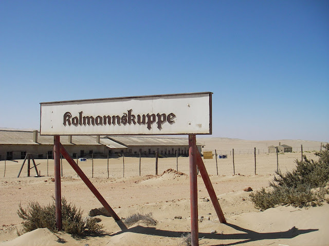
Kolmanskop is a ghost town in southern Namibia, a few kilometres inland from the port of Lüderitz. It was a small mining village and is now a popular tourist destination run by the joint firm NAMDEB (Namibia-De Beers).
It developed after the discovery of diamonds in the area in 1908, to provide shelter for workers from the harsh environment of the Namib Desert. The village was built like a German town, with facilities like a hospital, ballroom, power station, school, skittle-alley, theater and sport-hall, casino, ice factory and the first x-ray-station in southern Africa. It also had a railway line to Lüderitz.
The town declined after World War I as diamond prices crashed, and operations moved to Oranjemund. It was abandoned in 1956 but has since been partly restored. The geological forces of the desert mean that tourists can now walk through houses knee-deep in sand.


coordinates : 26°42'11.79"S 15°13'52.18"E
google map
pictures sources :
wikipedia
zapata
martijnverdonk
Jordi Boshoven
delpha
Okkert Brits
text source :
wikipedia
Artificial Owl recommends:
Read more [+]
Shipwreck of the Eduard Bohlen, conception bay, Skeleton Coast, Namibia
| .Namibia, Shipwreck | 0 comments »
The Eduard Bohlen was a ship that ran aground off the coast of Namibia's Skeleton Coast on September 5, 1909, in a thick fog. Currently the wreck lies in the sand a distance from the shoreline.
The ship was a 2,272 gross ton cargo ship with a length of 310 feet. In September 1909, it ran aground in thick fog and wrecked at Conception Bay while on a voyage from Swakopmund to Table Bay. This wreck is said to personify the loneliness of Namibia’s coast best. Its remains lie rusting in the sand, partially buried.
coordinates : 23°59'45.43" S 14°27'27.78" E
google map
pictures sources :
Michael Poliza
Paul Merrill
text source :
wikipedia
Artificial Owl recommends:


